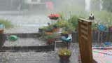
Deadly Flooding In South, Central Oklahoma
Sign up for the Morning Brief email newsletter to get weekday updates from The Weather Channel and our meteorologists.
An atmospheric river will continue to soak parts of California with heavy rain and mountain snow. Treacherous travel is possible in areas not only with heavy rain, but also heavier snow across Oregon, Idaho and Montana, as the storm begins to move to the east.
Latest Alerts
Flood watches have been issued by the National Weather Service for California's Central Valley, the Sierra below snow level and the Bay Area. The chance of localized flooding in these areas will last through Tuesday night.
A smattering of winter storm warnings and winter weather advisories are in effect across the West. Snow and wind in the areas covered in dark teal could make driving dangerous.
Latest Conditions
Right now, the steadiest rainfall is occurring in Northern California. Steadier snow is falling from the Siskiyous and Sierra to the Northern Rockies.
Parts of the foothills of the coastal ranges and Sierra have picked up 5 to 13 inches of rainfall since this weekend. A few reports of road flooding were observed around the Bay Area Monday night into early Tuesday.
Meanwhile, snow has dusted lowland areas of the Pacific Northwest. Seattle officially picked up 1.2 inches of snow on Sunday, marking its first measurable snowfall of the season. Parts of the northern Rockies of Idaho and southern Montana picked up from 16 to 32 inches of snow since last Friday.
Timing The Forecast
This atmospheric river will bring steady rain focused in Northern California through Tuesday evening, and heavy mountain snow from southern Oregon into the Sierra Nevada and the northern Rockies. The main disturbance creating the west conditions will depart toward the Plains and Midwest, becoming Winter Storm Freya.
(MORE: What Is An Atmospheric River?)
Here's the latest timing:
- Wednesday: Rain should diminish in much of California, except for some lingering showers, including in Southern California. On-and-off snow showers will continue to impact the Pacific Northwest, leading to slippery driving, particularly in the hills of these metro areas.
- Late Week: Another system will arrive on the West Coast Thursday into Friday. This will be a more typical Pacific system, not like the current atmospheric river event. That means it will be a colder system with more snow than rain in the Sierra and foothills. But once again, it will likely wring out most of its precipitation in northern and central California, with much lighter precipitation in Southern California.
(MORE: For even more granular weather data tracking in your area, view your 15-minute details forecast in our Premium Pro experience.)
How Much More Rain, Snow?
Storm total snowfall will be measured in feet across the Sierra, Siskiyous and northern Rockies.
Some lowland cities, including Seattle and Portland and Medford, Oregon, could see some light additional snowfall accumulations.
Additional rainfall totals in Northern California will be 1 to 3 inches on top of what has already fallen.
In Southern California, the best chance of at least an inch of rainfall will be in Santa Barbara County, with decreasing rainfall totals farther east into Ventura, L.A Counties and the Inland Empire through early Wednesday.
Jonathan Belles has been a graphics meteorologist and writer for weather.com for 8 years and also assists in the production of videos for The Weather Channel en español. His favorite weather is tropical weather, but also enjoys covering high-impact weather and news stories and winter storms. He's a two-time graduate of Florida State University and a proud graduate of St. Petersburg College.