Three weeks after Google announced Google Maps updates to help you stay safe in the event of a natural disaster, the company detailed a solution for a different kind of calamity: your commute.
In a blog post, Google revealed Maps can provide live traffic and delay updates for buses, which, prior to this update, wasn't possible in some areas, and predict how packed trains and buses will be.
This update may not come as a shock—Google crowdsourced this information from us. From October 2018 to June 2019, some commuters making their way to work between 6 and 10 a.m. received pop-ups asking whether their subway or bus ride was crowded. Based on that information, Google will tell you whether an upcoming train is relatively empty or standing room only. The information will be handy, especially for city dwellers. But ultimately, telling me my subway ride will suck doesn't alleviate the crushing dread that my subway ride will suck.
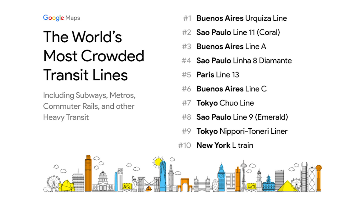
The data also reveals which cities have the most crowded transit lines, confirming that New Yorkers need to stop whining about their commute. Buenos Aires' Urquiza Line takes the number-one spot, followed by Sao Paolo's Line 11 and Buenos Aires' Line A (New York City's L train made NYC the only American city on the list and comes in at number 10.) The Google Maps update is available today in 200 cities worldwide.
More From PCmag
This article originally appeared on PCMag.com.

Get a daily look at what’s developing in science and technology throughout the world.